Ecology of Everglades Alligator Holes
Authors
Frank J. Mazzotti, Mark R. Campbell, Michelle L. Palmer, Jocie A. Graham, Karen Minkowski, Laura A. Brandt, Kenneth G. Rice
Description
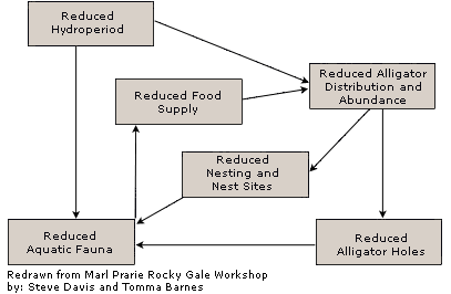
The American alligator (Alligator mississippiensis) creates small ponds, called alligator holes, by excavating substrate and vegetation. These holes are common in the Everglades and Frank Craighead in 1968 characterized alligator holes by these three components:
- A depression in the muck or limestone bedrock;
- Water to fill the resulting basin; and,
- Alligators to create and maintain the hole.
Function
- Provide water necessary for mating
- Act as dry season refugia for aquatic organisms
- Provide concentrated area for birds and mammals to forage
- Provide disturbance site for plant establishment through soil enrichment and removal of vegetation
- Increase overall diversity of Everglades
Questions
- Where are alligator holes?
- What do alligator holes look like?
- How are alligator holes arranged in space?
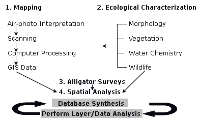
Methodology Flow Chart
Mapping Summary
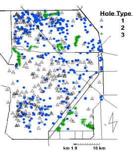
- Holes are classified into three categories by vegetation type.
- Color, infrared aerials (1:24,000) are adequate to map alligator holes.
- Minimum 5 m across, 20 cm deep
- Spatial accuracy 60 m
- Commission accuracy depends on size, location, and vegetation. Holes in sloughs are more difficult to identify than in wet prairies and sawgrass.
Surveying Alligator Holes
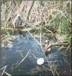
Ecological Characterization
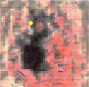
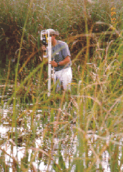
The image above is a digital enlargement of an alligator hole at 1 meter resolution. These field maps assist in classifying vegetation types, identifying alligator holes, and mapping vegetation. Yellow dot indicates location of picture on right.
- Small holes are structurally and vegetatively distinct from larger holes.
- Larger holes surrounded by woody vegetation provide upland habitat and increase the diversity and richness of the surrounding vegetation (Figure 4).
- Larger alligators (and hatchlings) are found in larger holes, while juveniles are found in surrounding smaller ponds - holes act as social refugia (Table 1).
General Vegetation Zones
- Type 1 Vegetation Zone: Woody
- Type 2 Vegetation Zone: Marsh
- Type 3 Vegetation Zone: Artificia
| #Active-Spring | #Active-Fall | Trails | Adult | Hatch. | Juven. | Nest | Other* | |
| Type 1 | 5 (56%) | 7 (78%) | 9 | 9 | 7 | 0 | 1 | 3 |
| Type 2 | 5 (55%) | 8 (73%) | 11 | 0 | 0 | 5 | 0 | 3 |
| Type 3 | 7 (78%) | 8 (89%) | 9 | 3 | 5 | 1 | 2 | 6 |
| Total | 18 (62%) | 23 (79%) | 29 | 5 | 12 | 6 | 3 | 12 |
| *Other signs include: tail drags, footprints, sunning spots or gator dens. | ||||||||
Table 1. Number of Alligators Observed at Different Hole Types
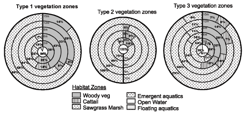
Figure 4. Composition of Vegetation in Three Meter Rings from Edge of Open Water.
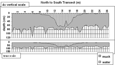
Figure 5. Example of transect data for an alligator hole showing water and muck depths in the North to South direction. Note vertical scale exaggeration.
Spatial Analysis
- Holes are clustered, but clusters are not.
- Clusters are 3 km apart.
- Vegetation and canals have an effect on overall hole distribution.
- Fewer holes than expected are found within 1 km of a canal.
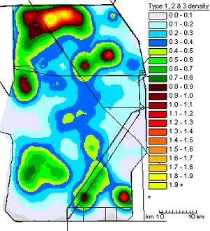
Figure 6. Density Map: All Holes
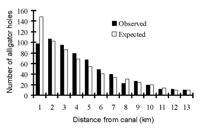
Figure 7. Number of Alligator Holes as compared to distance from canal.
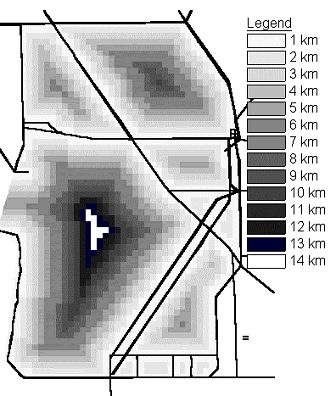
Figure 8. Canal Influence. Number of Alligator Holes as Compared to Distance from Canal at 1 km increments.
Acknowledgements
This research was supported in significant part by the Everglades Agricultural Area Environmental Protection District and the National Fish and Wildlife Foundation.
Citation
Pearlstine, L.G., F.J. Mazzotti, E.V. Pearlstine and G. Mann. (2004, December). Integrating Urban Growth Models and Habitat Models for Ecological Evaluation of Landscape Impacts. Poster presented at the National Conference on Ecosystem Restoration, Orlando, Florida.


